Key Takeaways
- Explore trails above 8,000 ft for cooler temperatures.
- Drive times from major cities provide convenience for quick getaways.
- Ensure hydration as shade and water availability vary by trail.
- Check for required permits, as some trails necessitate advanced reservations.
- Be aware of altitude sickness and prepare accordingly with proper acclimatization.
When summer temperatures soar in the desert regions of Arizona, Utah, and Colorado, hiking at high elevations offers a cooler alternative. After several hikes in these regions, I’ve discovered some of the best trails that not only provide breathtaking views but also stay refreshingly cool during the heat of the summer. The allure of high-altitude hiking lies in its ability to deliver stunning vistas while keeping temperatures manageable, often 20-30°F lower than the valleys below.
1. Mount Elbert, Colorado
At an elevation of 14,440 ft, Mount Elbert is the highest peak in Colorado and offers an exhilarating challenge. The 9 mi round trip hike via the South Mount Elbert Trail typically sees temperatures around 60°F in the afternoon, compared to the 90°F in the valleys below. The trail is well-maintained, with a steady ascent that features a rocky path. There’s limited shade, so it’s essential to start early to enjoy the cooler morning air. Drive from Denver takes approximately 2.5 hours via I-70 and CO-24. No permits are required, but visitors should start before 7 AM to avoid afternoon storms and ensure return before dark. As you ascend, be prepared for the possibility of altitude sickness; staying hydrated and acclimating can help mitigate these effects. The best months to hike are from late June through September, when the trail is free from snow, and wildflowers dot the landscape. Additionally, pack a windbreaker, as conditions can change rapidly at this elevation.
2. Humphreys Peak, Arizona
Standing at an impressive 12,633 ft, Humphreys Peak is the highest point in Arizona. The 10 mi round trip journey from the Snowbowl parking area provides a respite from the summer heat, with average afternoon temperatures around 65°F. The first half of the trail is shaded, particularly in the forested sections, but the last stretch is rocky and exposed. Accessible within 2 hours from Phoenix, the trail requires a parking fee at the Snowbowl. It’s advisable to arrive early to secure parking and avoid crowds, especially on weekends. Bring ample water, as there are limited water sources along the way, and a minimum of 3 liters is recommended. The trail can get crowded, particularly during peak summer months, so weekdays are preferable for a quieter experience. The best months for this hike are June through September, with wildflowers in bloom during early summer, making it a picturesque trek. Additionally, consider layering your clothing, as temperatures can fluctuate significantly from the base to the summit.
3. Kings Peak, Utah
As the highest peak in Utah at 13,528 ft, Kings Peak offers a dramatic escape. The 28 mi round trip hike via the Henry’s Fork trail typically features temperatures around 70°F compared to the sweltering valley heat. The hike is challenging and demands a good level of fitness, but the wildflower-filled meadows and stunning views make it worthwhile. The trailhead is about 4 hours from Salt Lake City, with the last part of the drive requiring a high-clearance vehicle. A backcountry permit is mandatory for overnight trips, which can be obtained through the Uinta-Wasatch-Cache National Forest. Ensure to check trail conditions before heading out, as snow can persist into late June. This hike is best tackled in late summer when temperatures are cooler and the trail is more accessible. Plan for at least 2-3 days if you wish to complete this hike as an overnight backpacking trip, allowing time to explore the surrounding lakes and valleys. Also, keep an eye out for wildlife, including deer and moose, which are prevalent in this area.
4. Mount Sneffels, Colorado
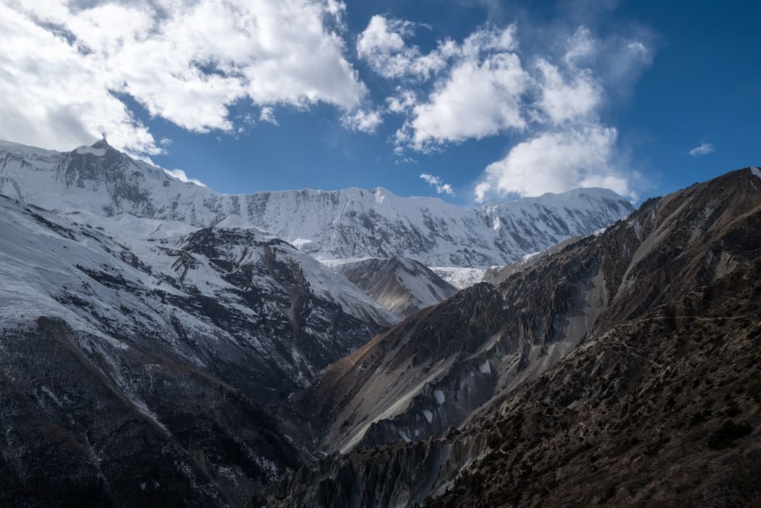
Mount Sneffels peaks at 14,197 ft and offers hikers stunning views of the surrounding San Juan Mountains. The 7.5 mi hike features varying temperatures averaging around 68°F in the afternoons, providing a refreshing change from valley heat. The trail begins at Yankee Boy Basin, known for its wildflowers and dramatic scenery, particularly in late July and early August. Drive time from Telluride is approximately 1 hour, with the last section of the road requiring a high-clearance vehicle due to rough terrain. A free permit is required for parking, which can be obtained at the trailhead. Be cautious of afternoon thunderstorms, which are common in the summer months. This trail is best attempted from late June through September when the wildflowers are in full bloom and the weather is generally stable. To ensure a safe hike, it’s wise to monitor the weather forecast and be prepared to turn back in case of approaching storms. Also, consider bringing trekking poles for stability on the rocky sections near the summit.
Comparison Summary
| Trail Name | Elevation (ft) | Distance (mi) | Typical Afternoon Temp (°F) | Drive Time from City | Shade/Water Availability | Permit/Fee |
|---|---|---|---|---|---|---|
| Mount Elbert | 14,440 | 9 | 60 | 2.5 hours from Denver | Low | No |
| Humphreys Peak | 12,633 | 10 | 65 | 2 hours from Phoenix | Moderate | $5 parking fee |
| Kings Peak | 13,528 | 28 | 70 | 4 hours from Salt Lake City | Low | Backcountry permit required |
| Mount Sneffels | 14,197 | 7.5 | 68 | 1 hour from Telluride | Moderate | Free permit required |
Always check local weather conditions and trail reports before heading out. High elevations can lead to quick changes in weather and potential altitude sickness.
Best pick if you want a challenging hike with stunning views and cooler temperatures. Each of these trails offers unique experiences and varying levels of challenge, allowing you to select one that suits your hiking ability and desire for adventure.
Related Guides
- Camping in Colorado: Alpine Lakes & Starlit Nights
- Fall Foliage in Colorado: Best 2026 Hikes and Scenic Drives by Elevation
- The Best Fall Foliage Drives in New England for 2026: State-by-State Guide
- 2 Days at Acadia National Park: A Realistic Schedule
- Arizona Outdoors: Trails, Camps & Canyon Country

2 thoughts on “Chill Out: Best High Elevation Hikes to Escape the Arizona, Utah, and Colorado Heat”